Welcome to our ThanksLetter!
April was one of those months where the calendar filled up fast. Forums, investor briefings, research kickoffs, and field visits across multiple countries kept the team moving. Across all of it, one question kept surfacing. How do you prove that climate action is actually working? This issue is about the answers we are building.
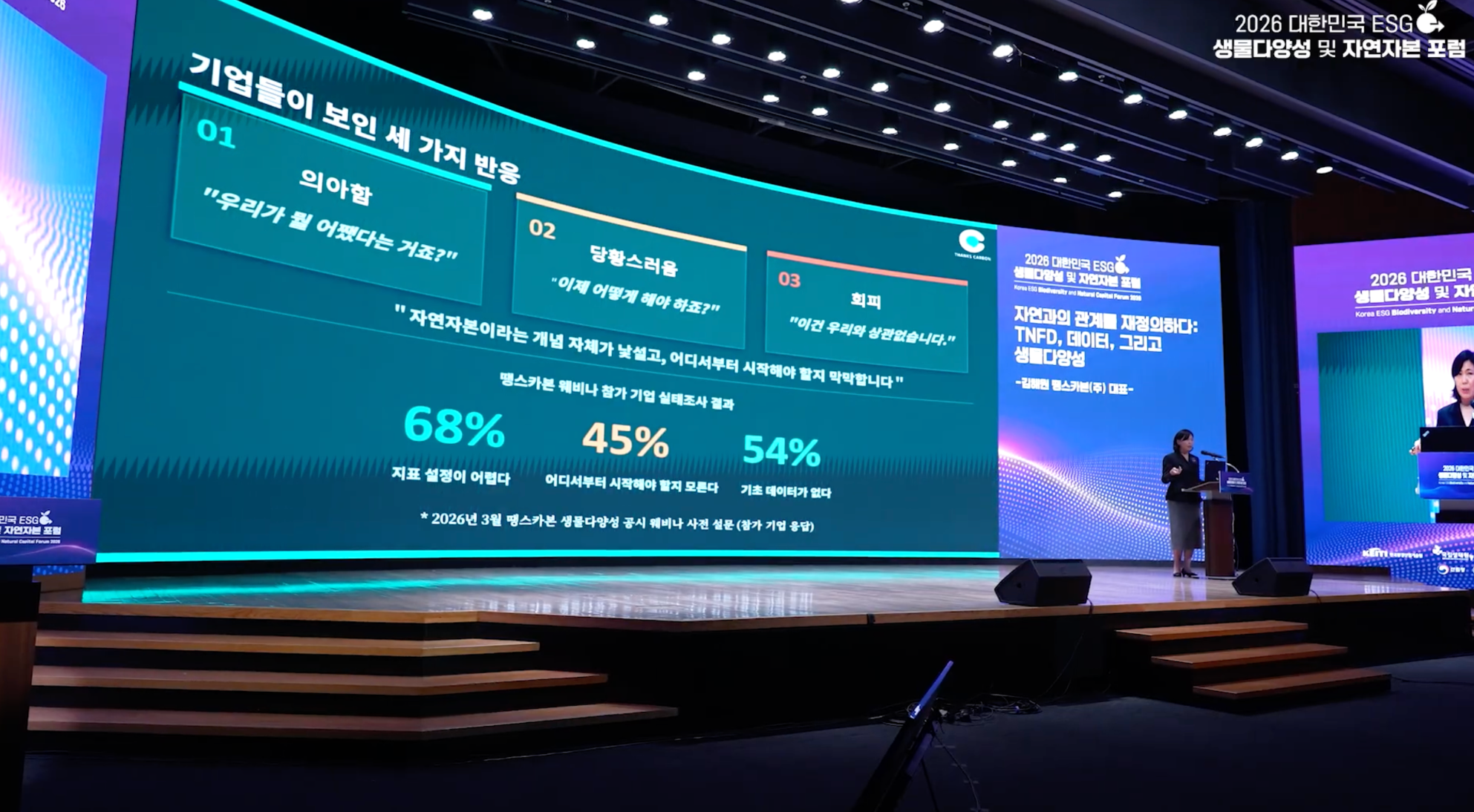
Korea ESG Biodiversity and Natural Capital Forum 2026
On April 22nd, Earth Day, ThanksCarbon's CEO took the stage at the Korea ESG Biodiversity and Natural Capital Forum 2026, co-hosted in Seoul by Energy Economy Newspaper and the Environment Foundation, drawing around 500 participants from business, government, and academia. The presentation started from where companies actually are: unclear on which indicators to use, unsure where to begin, and short on baseline data. Satellite imagery, acoustic AI, and environmental DNA were introduced as practical tools for measuring ecosystem change, and the TNFD LEAP framework was offered as a way to structure the full process from site boundary to risk assessment to disclosure-ready reporting.
The forum's other sessions covered the expanding corporate mandate to disclose natural capital risks alongside climate, illustrated through field restoration examples; the gap between disclosure frameworks and the practical realities of on-the-ground biodiversity work; and the structural drivers of biodiversity loss and what genuine ecosystem restoration actually requires. The sessions covered different ground, but pointed to the same conclusion: as the shift from carbon-only ESG to natural capital accelerates, what companies need is not another declaration but data they can stand behind.
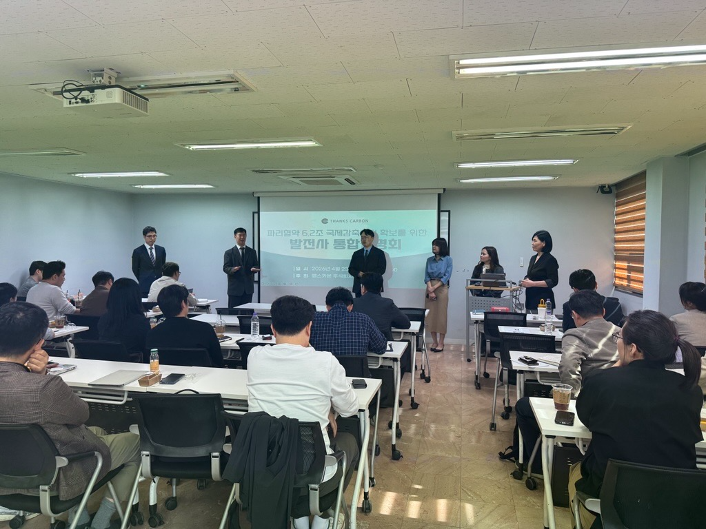
Article 6.2 Briefing for Korea's Power Sector
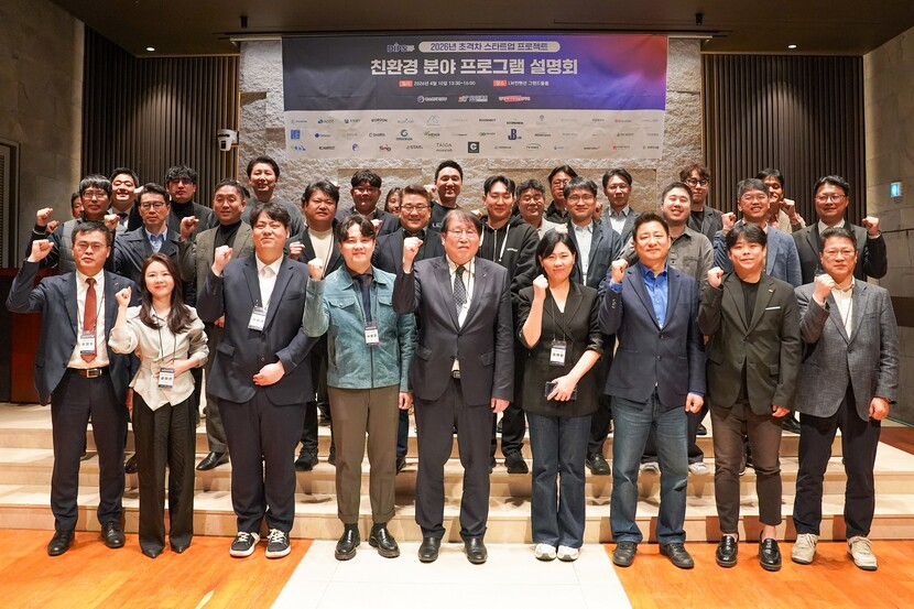
The following day, April 23rd, ThanksCarbon hosted its own event: a strategic briefing for Korea's power generation sector on securing ITMOs under Article 6.2 of the Paris Agreement. Samsung Electronics, SK Group, GS Energy, KOSPO, KOMIPO, KOWEPO, and Ecoeye attended, alongside financial institutions including IBK Securities and Korea Investment & Securities, and the NIGT(National Institute of Green Technology). Over two hours, the briefing walked through AWD methodology and a live Haimdall MRV platform demonstration, project operations and current status, the Article 6.2 framework, and an investment proposal. Close to half of the Battambang project area has already been matched with confirmed investment partners who have completed on-site due diligence. This briefing was about finding partners for the next phase, and the level of interest from attendees reflected that.
Biodiversity disclosure and international greenhouse gas reduction represent different priorities for different organizations. ThanksCarbon works across both, with the technology and field experience to make either concrete. If either is on your agenda, we'd be glad to start a conversation.
Quick Summary
- ThanksCarbon's April presence across biodiversity and carbon
- The Question Behind Every Climate Project: Verdica - Where Satellite Data Becomes Project Evidence
- MKCF SMART-RICE Project: Official launch of the Mekong regional initiative
- Korea-Germany BiodivAID Kickoff: Joint biodiversity AI research launched in Kassel
- Bangladesh Narsingdi Kickoff: New ground for ThanksCarbon's AWD work
- Climate Finance, In Practice: ThanksCarbon Speaks at the World Bank's Korea Green Innovation Days
- Gold Standard's new methodology: Where the satellite MRV market is heading
Project Highlights
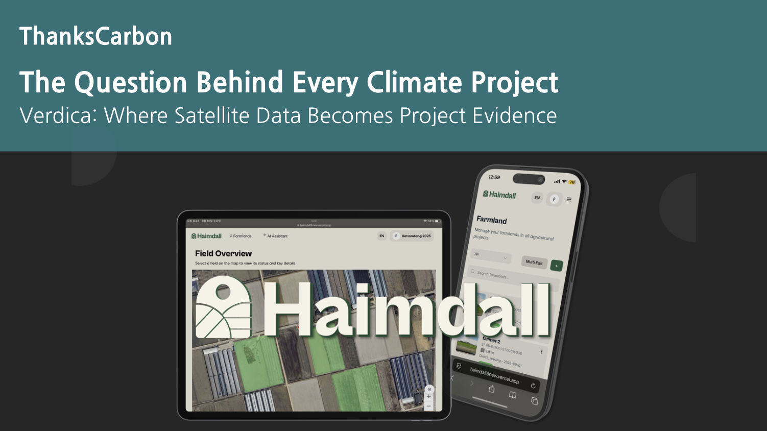
The Question Behind Every Climate Project
Verdica: Where Satellite Data Becomes Project Evidence
Every carbon project, every biodiversity disclosure, every supply chain audit eventually runs into the same challenge: how do you show that something actually changed? A commitment on paper is a starting point. What investors, regulators, and verification bodies increasingly require is evidence that is location-specific, time-stamped, and independently verifiable. Verdica is built for exactly that.
Verdica is ThanksCarbon's satellite-based vegetation monitoring tool, integrated into the Haimdall platform. Where Haimdall cross-validates satellite observation with field-level data, Verdica adds the dimension of time. It tracks how vegetation and land conditions in a project area shift across seasons and years, building a continuous, satellite-derived record that is objective and externally verifiable. That record can be revisited, audited, and compared at any point.
The regulatory context makes this increasingly relevant. EUDR, CSDDD, TNFD, and the EU Battery Regulation all require companies to demonstrate what is actually happening in and around their supply chains. For manufacturers in battery, automotive, electronics, and other sectors, the challenge runs deep: production and sourcing operations span dozens of countries, and in some of those locations, forest cover, water availability, and land use are actively shifting. At that scale, field visits and supplier questionnaires alone are not built to carry the documentation burden those regulations impose. Satellite-based remote monitoring is a practical answer to the geographic scope involved.
ThanksCarbon is already applying this approach at active project sites, where Verdica is tracking field conditions across AWD projects in Cambodia. The same workflow that supports carbon credit baseline documentation there connects directly to the corporate supply chain use case: establish what conditions looked like before an intervention or a reporting period, then maintain a comparable record going forward. For AWD carbon projects, that means a verifiable starting point for credit issuance. For companies managing supply chain disclosures, it means evidence that holds up under external review.
What Verdica changes, practically, is where the verification work happens. Rather than organizing costly, logistically complex surveys across dispersed sites, organizations can establish and update their environmental baseline from a browser interface, drawing on satellite scenes that cover the full project area on a regular revisit cycle. Field data remains part of the process, but the satellite layer carries the documentation burden that would otherwise require continuous physical presence. For investors and institutional partners assessing the credibility of a project or a disclosure, the result is an auditable record that exists independently of the reporting entity.
Baseline documentation for AWD carbon projects, environmental change tracking across supply chains, TNFD, EUDR, and CSDDD compliance reporting: these are the use cases Verdica is built for. If you would like to explore what is possible with Haimdall and Verdica, we would be glad to hear from you.
ThanksCarbon Updates
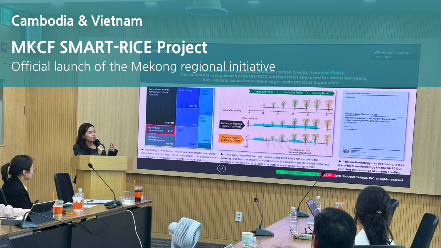
MKCF SMART-RICE Project
Official launch of the Mekong regional initiative
On April 17th, the SMART-RICE project held its official launch. Selected from a field of more than 300 competing proposals for the Mekong-Korea Cooperation Fund (MKCF), the project aims to reduce methane emissions from rice cultivation in Cambodia and Vietnam through AI and satellite-based MRV systems. The consortium includes the National Institute of Green Technology (NIGT) and the Asian Forest Cooperation Organization (AFoCO), with project partners from both countries joining online.
ThanksCarbon serves as the technical partner driving the digital work across this 24-month initiative. The core tasks are building the AI and satellite-based MRV system, developing an AWD scheduler to cut methane emissions from rice paddies, and running pilots across 60 hectares in Takeo Province, Cambodia and An Giang Province, Vietnam. At the launch event, ThanksCarbon presented a baseline report covering key findings from the pilot areas alongside an overview of the MRV technology. Partners then discussed the collaboration structure and the roadmap ahead. The Mekong region produces 25% of the world's rice while emitting more than 50 million tonnes of methane annually. Changing that is what this project is designed to do, and ThanksCarbon is in the middle of it.
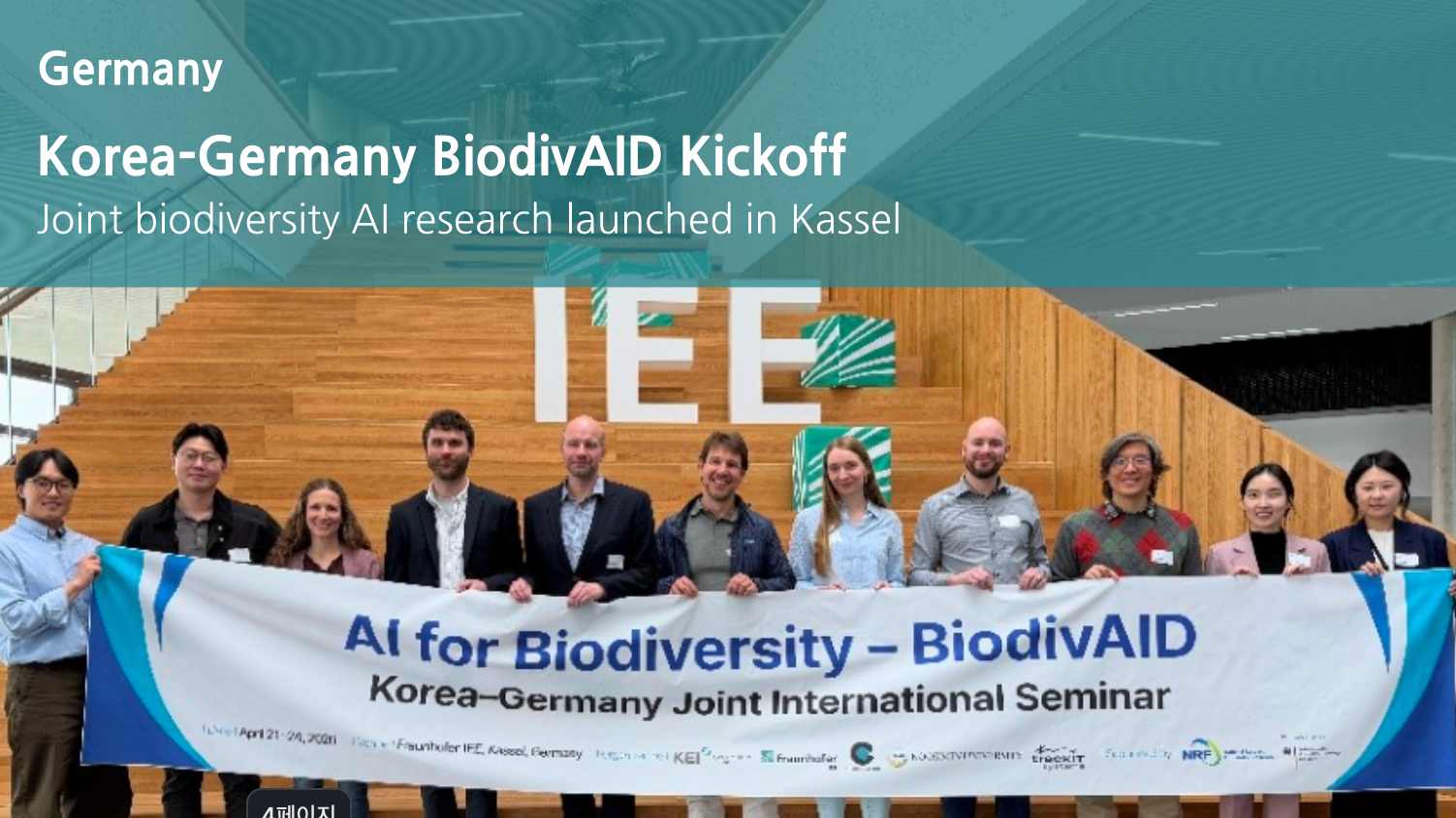
Korea-Germany BiodivAID Kickoff
Joint biodiversity AI research launched in Kassel
From April 21st to 24th, ThanksCarbon participated in the kickoff event for BiodivAID, a Korea-Germany 2+2 industry-academia joint research project, held in Kassel, Germany. Research institutions and companies from both countries gathered, including the Korea Environment Institute (KEI), Kookmin University, the Fraunhofer Institute, and TrackIT Systems. The four-day program moved from research presentations and collaboration discussions to acoustic monitoring field visits, a live data demonstration at TrackIT Systems' headquarters, and a visit to a UNESCO nature park.
ThanksCarbon presented as the team responsible for BiodivAID platform development and TNFD mapping. A survey of corporate biodiversity disclosure needs found that 68% of respondent companies had stalled at the Locate and Evaluate stages of the TNFD LEAP framework. ThanksCarbon walked through field monitoring cases from sites in Ulsan and Yeosu Gasari, and outlined a platform approach capable of addressing multiple global disclosure standards at once, including TNFD, GRI 101, ESRS E4, CSDDD, and EUDR. The project targets practical deployment by 2028, with the next meeting scheduled to take place in Korea.
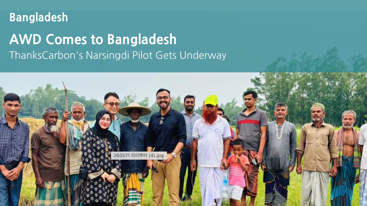
AWD Comes to Bangladesh
ThanksCarbon's Narsingdi Pilot Gets Underway
On April 30th, ThanksCarbon held the kickoff meeting for its KOICA IBS project in Bangladesh, together with local partners CNRS(Center for Natural Resource Studies), SSG(Super Star Group), DAE(Department of Agricultural Extension), and BADC(Bangladesh Agricultural Development Corporation). The meeting marked the formal start of a proof-of-concept in Narsingdi covering 30 hectares of rice paddies, combining solar-powered irrigation, AWD farming practices, and digital MRV. Running from December 2025 through July 2027, the project targets both methane reduction and improvements in farmer productivity and income.
The experience built in Cambodia and Vietnam now extends to Bangladesh. Supported by the Korean government, this pilot is designed as a scalable model for sustainable agriculture that can spread across the country. ThanksCarbon's operational footprint continues to grow.
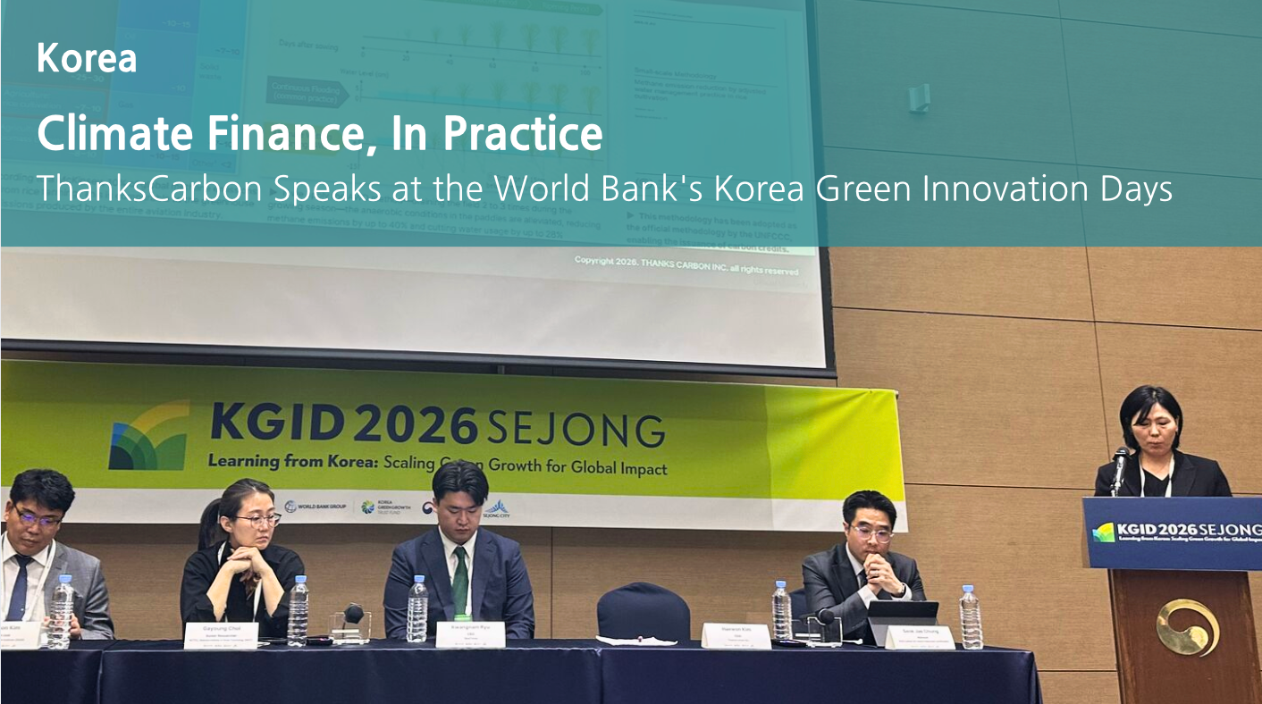
Climate Finance, In Practice
ThanksCarbon Speaks at the World Bank's Korea Green Innovation Days
On May 7th, ThanksCarbon participated as an official partner and speaker at the 15th Korea Green Innovation Days (KGID 2026), hosted by The World Bank Group and World Bank Group Korea Green Growth Trust Fund(KGGTF) at the Sejong Convention Center. The event brought together policymakers, development institutions, and climate practitioners around a central theme: scaling green growth for global impact by drawing on Korea's experience.
ThanksCarbon presented in the Climate Finance Session. The central question of the session was how to move promising climate solutions into something that actually works in the field. ThanksCarbon shared what that looks like in practice: Haimdall, a digital MRV platform that reduces verification costs by 97% while keeping field data traceable and transparent, alongside the progress made on its Article 6.2 project in Cambodia. The message was straightforward: for climate finance to flow where it needs to go, the data infrastructure and operational systems have to be in place first. [Read more on LinkedIn]
ThanksCarbon's engagement with the World Bank extends beyond this event. Last week, ThanksCarbon was in Singapore for Innovate4Climate (I4C) 2026, one of the most significant gatherings of the global carbon market community. We will cover that in the next ThanksLetter.
Global Climate Context
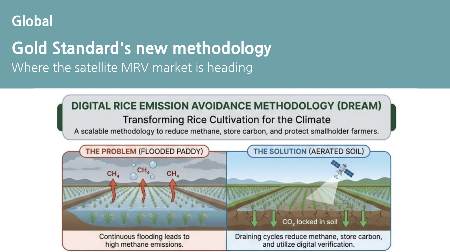
Gold Standard's new methodology
Where the satellite MRV market is heading
On April 22nd, Gold Standard released a draft methodology for AWD-based rice cultivation projects: DREAM, the Digital Rice Emission Avoidance Methodology. With both Gold Standard and Verra reinforcing their frameworks for satellite-based digital MRV and data verification, global attention to this space is rising quickly.
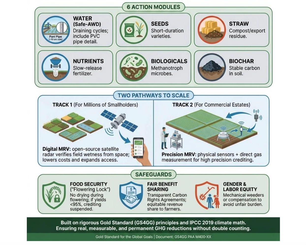
DREAM is Gold Standard's next-generation AWD methodology. Its core contribution is a standardized, low-cost pathway for verifying water management changes in rice paddies at scale, using satellite-based digital MRV and RCU/cluster-level quantification. The methodology splits into two tracks: Track 1, designed for smallholder aggregation and ease of participation, and Track 2, for large-scale operations requiring precise direct measurement. The design aims to expand AWD adoption in the field without sacrificing data credibility. Where previous methodologies kept smallholder farmers out through high on-the-ground costs, DREAM is built to bring them in. That is the direction ThanksCarbon has been moving with Haimdall and its new capability, Verdica.
What's new
- Previous rice emission methodologies relied on costly field measurement and heavy documentation. DREAM uses satellite-based digital MRV and conservative default values to lower the barrier for smallholder participation considerably.
- Rather than treating each paddy as a standalone project unit, small plots can be grouped into Aggregated Cluster Polygons and verified as a single asset, making the approach workable even where satellite resolution has limits.
- The modular structure covers not just methane reduction but also fertilizer management, straw handling, and biochar, allowing a whole-farm view of both reductions and removals within the same framework.
What satellite data actually does here
- Satellite imagery is the mechanism for confirming, across large areas and on a repeating basis, whether fields actually dried out and were re-flooded as AWD requires.
- Under Track 1, radar satellites such as Sentinel-1 are used to assess whether AWD has been implemented, making verification feasible without frequent physical site visits.
- That said, satellite data alone is not the complete picture. Geotagged field photos and sample on-site checks are used to calibrate and validate what the satellite observes.
Verdica sits at the center of this. DREAM points toward a carbon market where satellite-based verification is not optional infrastructure but the standard against which projects are assessed. ThanksCarbon has been moving in that direction. As methodologies like DREAM define what credible monitoring looks like, ThanksCarbon's work in the field is already aligned with where that bar is being set.
📌 Related articles
Stay Connected
Are you ready to drive sustainable change with ThanksCarbon? Whether you're looking to scale agricultural impact or meet new biodiversity standards, we're here to collaborate.
Stay connected through our website or social channels to receive more updates and collaboration news. See you in our next edition!




의견을 남겨주세요